About

A council of neighbors, for neighbors.

The Empowerment Congress West Area Neighborhood Development Council (ECWA) is one of 99 neighborhood councils certified by the City of Los Angeles. We are a vehicle for stakeholders to shape the policies and decisions that affect their lives.

Our purpose

The mission of a neighborhood council is to continuously improve the quality of life for its stakeholders and ensure a safe, healthy and economically sustainable community. ECWA is dedicated to:

  • Working with community stakeholders and city officials to identify community concerns, develop solutions and advocate for the resources and public policies needed to meet the needs of the community.
  • Promoting and increasing civic engagement and community participation in government through timely access to information, decision-making and opportunities for leadership.
  • Making government more responsive to the needs of the community and facilitating the delivery of city services and city government responses to ECWA’s issues and requests for assistance.
  • Fostering a sense of community and supporting dialogue, interaction and cooperation among the diverse socio-economic and ethnic stakeholders who make up the community.
  • Collaborating with other communities and neighborhood councils on common issues and concerns.

Who are our stakeholders?

Membership is open to all stakeholders. A stakeholder is anyone who lives, works or owns real property within our boundaries, and anyone who declares a stake in the neighborhood as a community interest stakeholder: a person with substantial and ongoing participation within the boundaries who may be part of a community organization such as an educational, nonprofit or religious organization. Members of the council are referred to as community stakeholders.

Our history

The neighborhood council system was created by the 1999 Los Angeles City Charter to make city government more responsive to the city’s diverse communities. Each council receives an annual budget from the city, and its board members, all volunteers, are residents, workers, property owners and business owners elected or appointed from the community.

ECWA grew out of the Empowerment Congress, the civic engagement movement launched on January 23, 1992 as the "Campaign for a New Eighth District" by then-Councilmember Mark Ridley-Thomas. Four Empowerment Congress neighborhood development councils (West, Central, Southwest and Southeast) now serve South Los Angeles. ECWA was certified by the City of Los Angeles on March 23, 2002, the eighteenth council to be certified in the city.
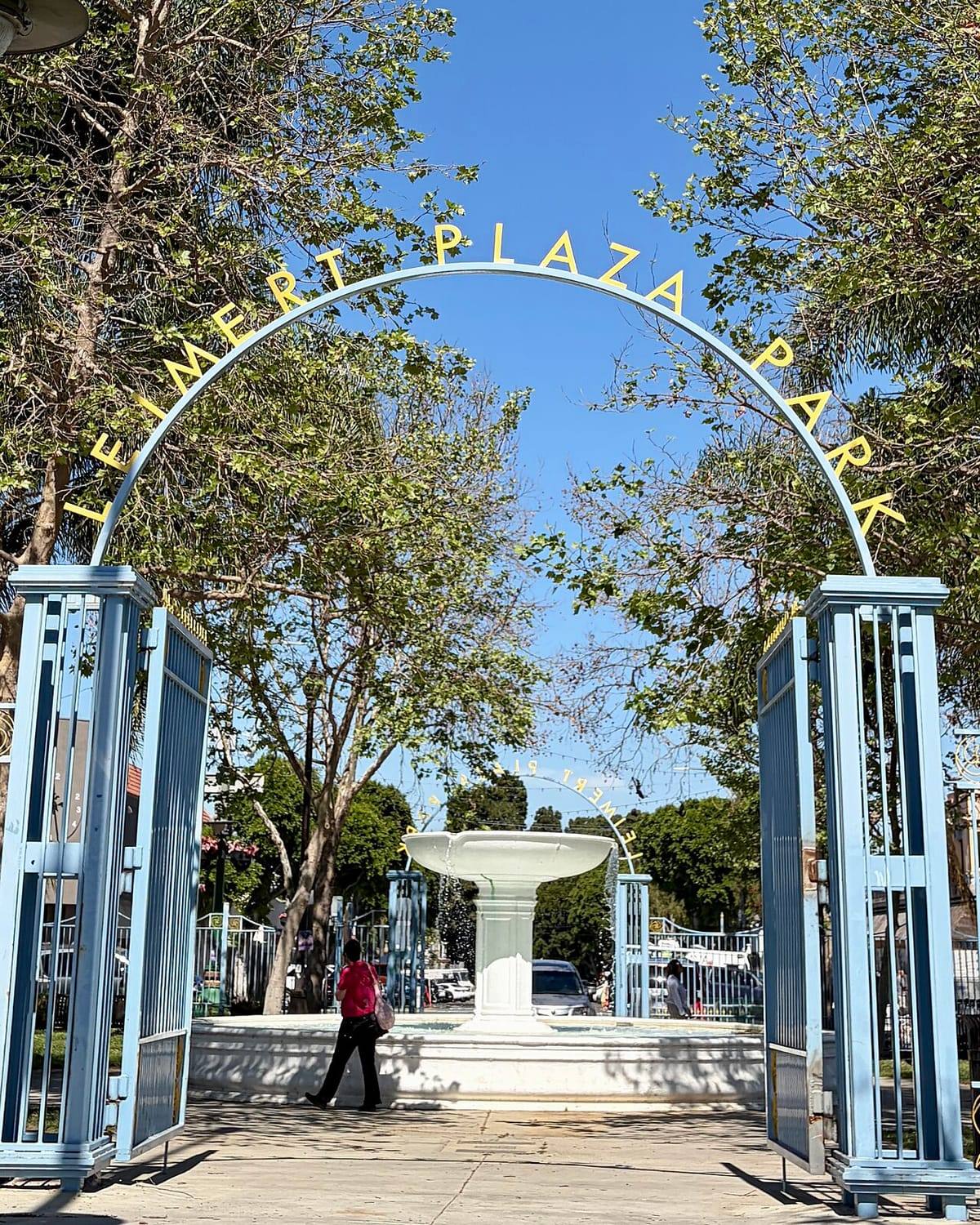
Looking through the open light-blue gates of Leimert Plaza Park, beneath a gold arch reading Leimert Plaza Park, toward the white central fountain
Leimert Plaza Park, designed by the Olmsted Brothers in 1928.

At a glance

  • Certified March 23, 2002
  • 15-member board, two-year terms
  • General meetings 1st Saturday, 10 AM
  • Board meetings 3rd Monday, 6:30 PM
  • Region: South Los Angeles Area
  • EmpowerLA profile
Service area

Our boundaries

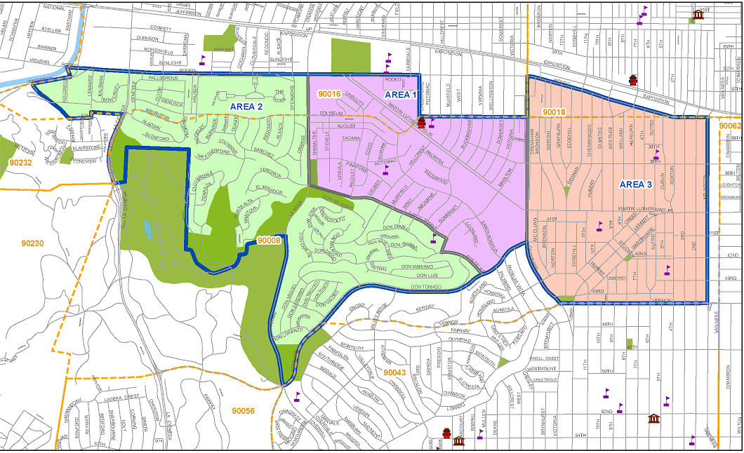
Our district is divided into three areas. Each area elects two representatives to the board, and a stakeholder may hold an area seat only for the area in which they have stakeholder status.

Area 1 ZIP 90016

La Brea Avenue on the west, Crenshaw Boulevard on the east, Coliseum Street on the north to Chesapeake Avenue and Obama Boulevard, and Santo Tomas Drive to the south.

Area 2 ZIP 90008

Jefferson Boulevard at the Culver City line on the west, La Brea Avenue and Santo Tomas Drive on the east, and Stocker Street to the south.

Area 3 ZIP 90018

Crenshaw Boulevard (from Stocker Street to Obama Boulevard) and the city border (from Stocker Street to Vernon Avenue) on the west, Arlington Avenue on the east, Obama Boulevard on the north and Vernon Avenue on the south.

Boundary descriptions are from Article III of the council bylaws (PDF).

Map of the council boundaries with Area 1 shaded purple in the center, Area 2 shaded green to the west in the Baldwin Hills, and Area 3 shaded orange to the east around Leimert Park
Boundary map from the Los Angeles City Clerk.
Eight neighborhoods

The communities we serve

Historic planned communities, hillside enclaves and one of the great cultural districts of Black America, all within a few square miles.

Leimert Park

Area 3

Laid out in 1928 by developer Walter H. Leimert with the Olmsted Brothers landscape firm, Leimert Park is one of the earliest planned communities in Southern California, with Spanish Colonial Revival homes on tree-canopied streets. Leimert Park Village, around Degnan Boulevard and 43rd Place, has been called the cultural heartbeat of Black Los Angeles: home of the Sunday drum circle at Leimert Plaza Park, the monthly Art Walk, the World Stage, and the restored 1931 Vision Theatre.

  • Leimert Plaza is a Los Angeles Historic-Cultural Monument
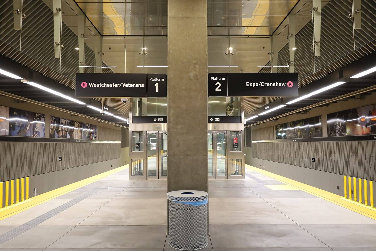
  • Served by the Metro K Line at Leimert Park station

Baldwin Hills Estates

Area 2

Known locally as "The Dons" because nearly every street name begins with Don, this hillside neighborhood looks out over the Los Angeles Basin from the Baldwin Hills. Its postwar homes and hillside views earned it the nickname "the Black Beverly Hills."

Village Green

Area 1

Completed in 1942 as Baldwin Hills Village, this 64-acre garden-city community by architect Reginald D. Johnson and planner Clarence S. Stein keeps cars to the edges and opens every home onto shared greens. It is a National Historic Landmark and one of the American Institute of Architects’ most significant works of American architecture.

  • National Historic Landmark since 2001
  • 627 homes on a central greensward

Baldwin Village

Area 1

Recognized as its own community in 1988, Baldwin Village sits east of Village Green and is one of the most densely populated parts of the district, with mid-century apartment courts and a strong network of tenant and block organizations.

Baldwin Vista

Area 2

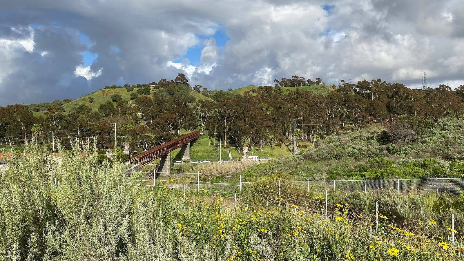
Hillside homes on the north face of the Baldwin Hills between La Cienega and La Brea, bordered by Kenneth Hahn State Recreation Area, whose trails and overlooks offer views from the Hollywood Hills to the ocean.

Cameo Plaza

Area 2

A quiet residential enclave in the Baldwin Hills area, represented on the council through Area 2.

Crenshaw Manor

Area 1

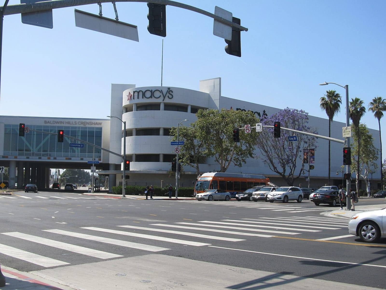
Homes and businesses along the Crenshaw corridor near Martin Luther King Jr. Boulevard and Baldwin Hills Crenshaw Plaza, at the doorstep of Destination Crenshaw, the 1.3-mile open-air celebration of Black Los Angeles art and history.

Arlington Park

Area 3

Tree-lined residential streets on the eastern edge of the district, between Crenshaw Boulevard and Arlington Avenue, south of Obama Boulevard and north of Vernon Avenue.

Green hills of Kenneth Hahn State Recreation Area under dramatic clouds, with a rust-colored pedestrian bridge and yellow wildflowers in the foreground
Kenneth Hahn State Recreation Area on the western edge of the district.
Underground platform at Metro Leimert Park station with signs for the K Line toward Westchester/Veterans and Expo/Crenshaw
Leimert Park station on the Metro K Line, opened in 2022.
Baldwin Hills Crenshaw Plaza at the corner of Crenshaw Boulevard and Martin Luther King Jr. Boulevard, with a jacaranda tree in bloom and a Metro bus passing
Baldwin Hills Crenshaw Plaza at Crenshaw and King.

Photographs from Wikimedia Commons contributors. See photo credits.

Join us

This is your council.

Meetings are open to everyone. Come as you are, bring your neighbors, and help decide what happens next.